

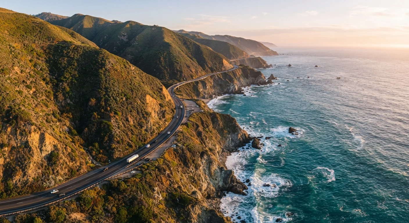
The Route at a Glance
California's Pacific Coast Highway — formally designated California State Route 1 — runs from Dana Point in Orange County north to Leggett in Mendocino County, where it merges with US-101. The full corridor covers roughly 650 miles, though most travelers focus on the stretch between Los Angeles and San Francisco, a distance of about 400 miles.
The highway doesn't follow one uniform character. It shifts between busy, walkable beach towns; remote coastal bluffs with no cell service; redwood-lined river valleys; and fog-wrapped headlands. Treating it as a single scenic ribbon misses the point — each segment earns its own planning.
~650 mi
Total length of California State Route 1
The highway runs from Dana Point in Orange County to Leggett in Mendocino County.
90 mi
Length of the Big Sur coastal stretch
The Big Sur segment between San Simeon and Carmel is the most frequently photographed section of PCH.
5–7 days
Recommended trip length for full exploration
Travel planners generally suggest at least five days to experience distinct segments without rushing.
Southern Segment: Dana Point to Malibu
This is the urban-coastal version of PCH. From Dana Point through Laguna Beach, Newport Beach, and up into Santa Monica and Malibu, the road runs close to sea level with easy beach access. Expect traffic, parking meters, and mid-morning gridlock during summer weekends.
What this stretch trades in solitude it returns in cultural texture. Laguna Beach's art galleries, the Santa Monica Pier, and the surf culture of Malibu's Zuma Beach all sit directly on or within a short walk of the highway. It's a genuine beach road — not a wilderness drive — and that distinction matters when you're setting expectations.
If you're driving the Southern California stretch on a weekend, leave before 8 a.m. to beat the beach traffic that stalls PCH between Santa Monica and Malibu by mid-morning.
The coastal lanes near LA have no viable parallel route, so delays on PCH simply mean waiting — there's no workaround once traffic builds.
Download an offline map of the entire route before you leave — Google Maps, Apple Maps, and Gaia GPS all support it — because cell service disappears for long stretches north of San Simeon.
Coverage gaps in Big Sur and the Sonoma Coast can extend 20–40 miles, and having a downloadable map removes one of the trip's most common stress points.
Central Segment: Malibu to San Simeon
North of Malibu the road begins to thin. You'll pass Point Mugu and enter the Santa Monica Mountains' coastal edge, where the four-lane urban road narrows and the ocean views open dramatically. The highway climbs over headlands and drops into coves between Oxnard and San Luis Obispo County.
Pismo Beach and Morro Bay are the practical overnight hubs here — genuinely charming and significantly less expensive than overnight stops closer to Big Sur. Morro Rock, rising 576 feet from the bay, is one of the more visually striking landmarks on the entire highway and is easy to access without a hike.
Also in this stretch: Hearst Castle sits above San Simeon, perched on a hilltop visible from the coast. Tours require advance reservations through the state park system and are worth the planning effort if architecture and California history interest you.
The Big Sur Stretch: San Simeon to Carmel
This is the 90-mile segment that defines the highway's reputation. From San Simeon northward through the Big Sur coast, the road hugs cliffs several hundred feet above the Pacific, threading through state parks, past redwood canyons, and over historic arch bridges. Bixby Creek Bridge — frequently photographed — sits about 13 miles south of Carmel.
The honest caveat: this section closes. Landslides, fire damage, and storm erosion have interrupted through-traffic multiple times in recent years. Before driving, check Caltrans QuickMap or call the Caltrans District 5 hotline for current conditions. There is no convenient detour — when Big Sur closes, it means a significant inland reroute via US-101.
Cell service is largely absent here, so download offline maps before entering. Gas up in San Simeon or Cambria heading north, or Carmel heading south. There are no gas stations in Big Sur.
Northern Segment: Carmel to Leggett
After Carmel and Monterey, the highway passes through the artichoke farms and dune fields of the Monterey Bay area, then rejoins rural coastal character north of Santa Cruz. From San Francisco northward — technically via State Route 1 through Marin County — the road becomes genuinely remote. Point Reyes National Seashore, the rugged Sonoma Coast, Mendocino's weathered Victorian village, and finally the Avenue of the Giants redwood corridor all lie along or just off this corridor.
This northern stretch receives far fewer travelers than Big Sur or the Southern California coast, which means lighter traffic, lower accommodation prices, and a very different mood. It's overcast and cool even in July. If what draws you to the PCH is solitude and raw coastal scenery, this is where you'll find it. The American Southwest road trip guide offers useful contrast for travelers deciding between desert and coastal routes.
Timing, Logistics, and Honest Trade-Offs
Spring (April–May) and fall (September–October) offer the most reliable driving weather — fewer coastal fog banks, lower summer crowds, and generally open roads. Summer brings the most visitors and the densest morning fog along the Central and Northern coasts, while winter carries the highest risk of slide closures in Big Sur.
Plan fuel stops deliberately. Between Carmel and San Simeon you may drive 50+ miles without services. Credit cards are accepted at most stations, but carrying some cash is useful in smaller coastal towns.
Driving direction matters more than most guides acknowledge. Southbound drivers sit on the ocean side of the road for most of the Big Sur and Central Coast segments, making it easier to pull off without crossing traffic. Northbound drivers have the inside lane, which limits spontaneous ocean-side stops.
Big Sur Road Closures Are Common
Landslides, wildfires, and storm damage have caused multi-month closures of PCH through Big Sur in recent years. Always check Caltrans QuickMap or the official Caltrans District 5 information line before committing to this route. Do not assume the road is open based on past trips or online reviews — conditions change quickly and without much warning.
Accommodation along Big Sur itself is limited and fills weeks in advance during peak season. Booking Carmel or San Luis Obispo as base camps and day-tripping into Big Sur is a practical alternative.
The content on this site is for informational purposes only and is not a substitute for professional advice. Always consult a qualified professional for guidance specific to your situation.